Elowan I absolutely hear you.
https://docs.quadspinner.com/Guide/Concepts/Scale.html the scal etheory here helped me a little in the past but it does still throw me on absolutely precision.
like if i were working small scale in CM MM i know i'd just ratio up to work within the gawa range more comfortably.
Arguably photoscanning the ground spins it again as height maps and depth sensors still normalise data and from a visual representative can end up missleading, but thats just because when we look at 2D height maps, we dont know what the scale wad originally.
ie
if we took a picture of the ground with a depth sensor at 1m high, 1m is our max height and the depth returns a very dark dull gray image of say just fine gravel on the floor because the max height of that would be only a few cms in comparison.
if i took the same photo this time from close up, not only is my scale in width different but my height would be whiter because theres less distance between the camera and the ground.
You're right though in that if you dont need perfect presicion, you could eye ball your blender and gaea view port to perceive it similarly.
i want you to be able to achieve high pressicion too!
i'm hoping one of the team can sweep this over and give a much better explination.
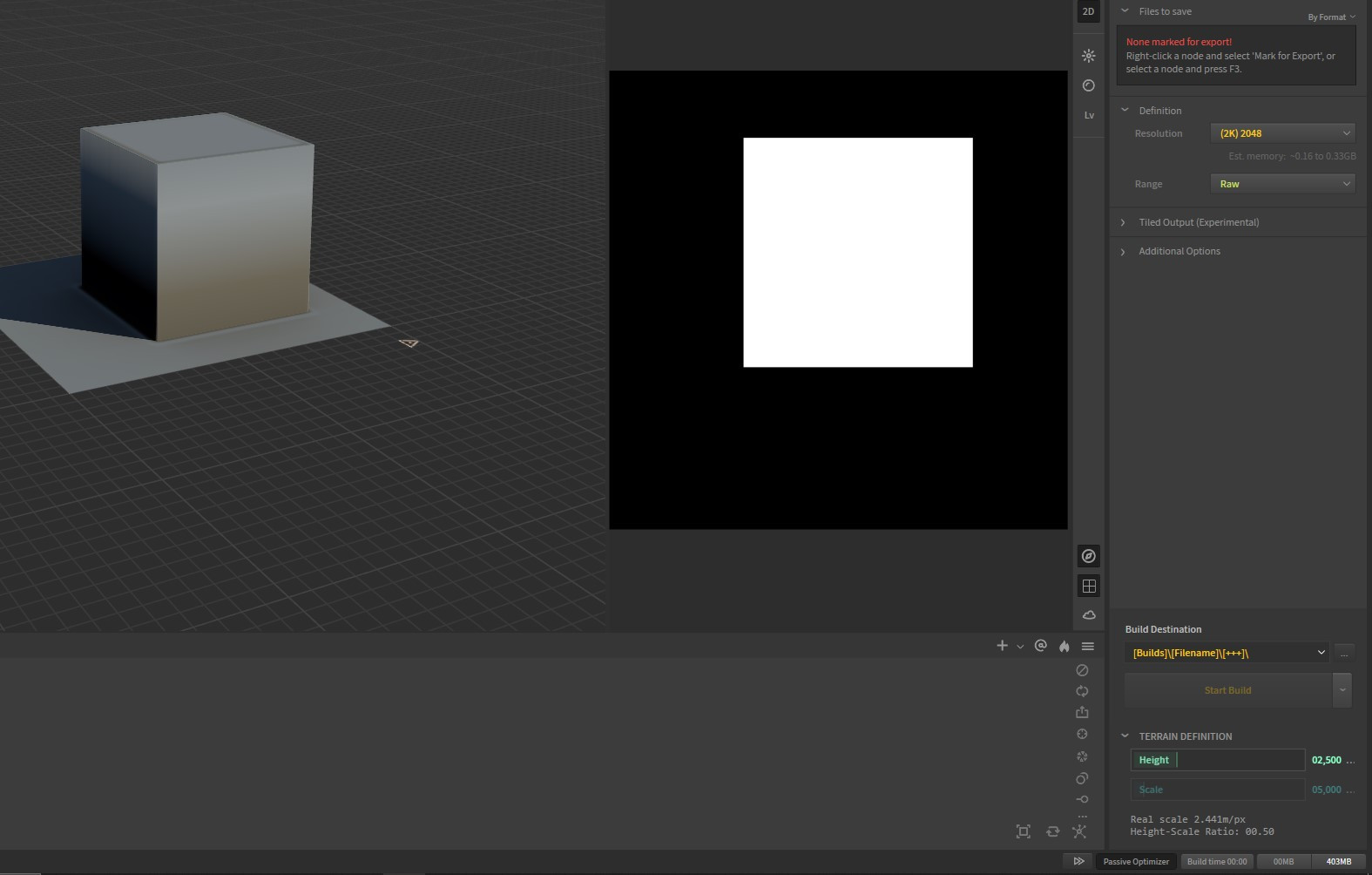
below i attached an image with the min max black white respectively.
the cube is 256pixels and the overall 512.
My understanding is that that is my scale ratio here 0.5 for the absolute "0-1" and my terrain etc etc would live inside that definition.
i hope you catch some progress on your ideas Elowan. i'd be looking forward to hearing your progress on it. Goodluck!